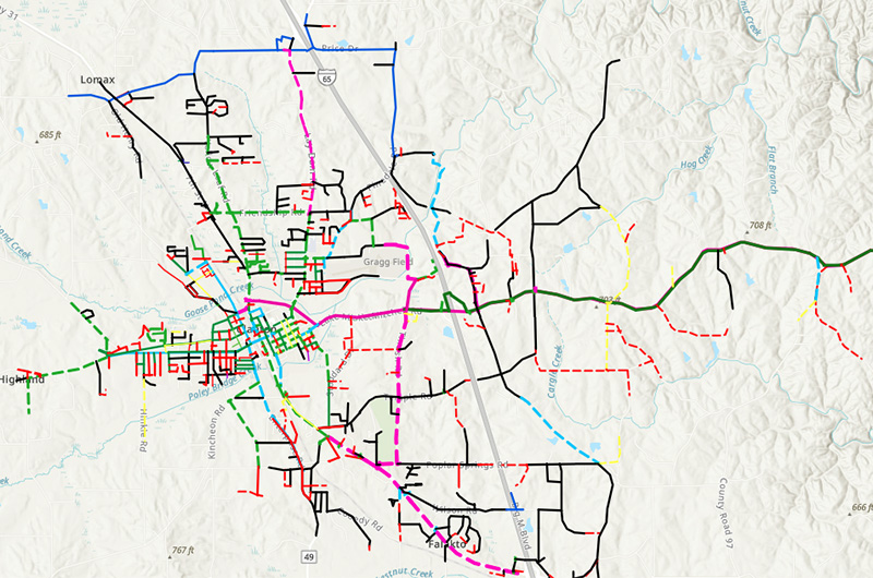
Clanton Water, Sewer and Pavement GIS Mapping
City of Clanton, AL
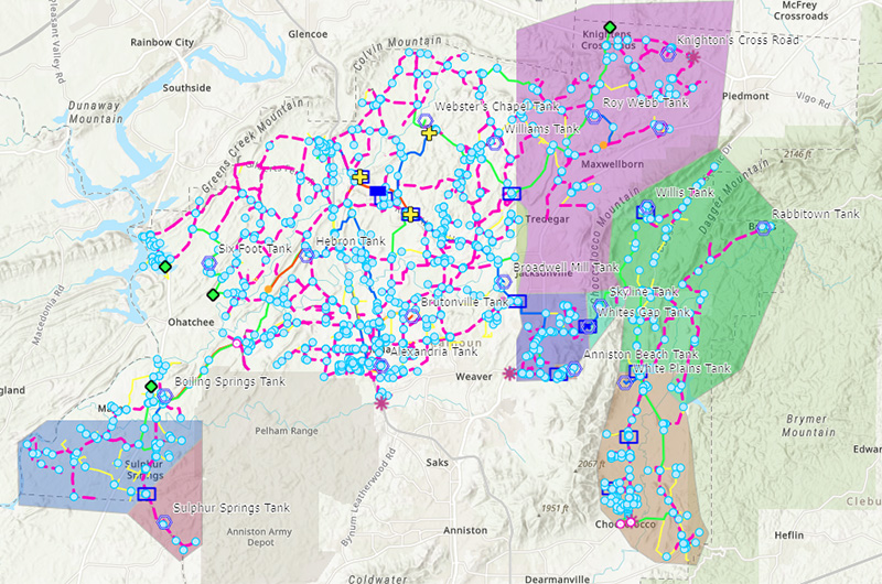
The City of Clanton wanted to digitize and map its current water, sewer and roadways into a GIS platform to make critical information readily available to the City’s employees, the Board, and the community. CDG collected and digitized data to characterize existing water and sewer and created a user-friendly web application for viewing and virtually navigating the systems. The map aids in identifying attributes and needs, tracking problems and progress and better understanding the system’s overall operations. The digitized information includes all infrastructure data the client has available, additional information collected by the CDG project team, and a comprehensive evaluation of the existing roadway pavement conditions.